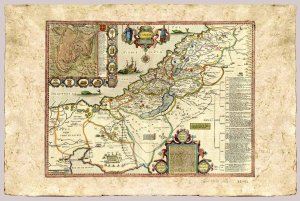
Unveil the mysteries of past with these remarkable early maps facsimile of the Holy Land and Jerusalem.
These maps are a must have for any collection, and are sure to make a tremendous and overwhelming gift.
Shows part of Egypt, the Sinai Peninsula, and the Holy Land on both sides of the Jordan, divided among the Tribes.
From "Prospect of the most famous parts of the World" by John Speed, 1552-1629.
The map was originally dated 1611 and included in Speed's "Genealogies of Holy Scriptures" inserted in the "Editio Princeps" of the King James Bible, published by Robert Barker.
Imprint by Thomas Basset and Richard Chiswell, London 1676.
From the Eran Laor Cartographic Collection. The Jewish National & University Library, Jerusalem
Not original coloring
This item is printed facsimile of an early map, it is printed on a special "parchment paper" which allows very high quality prints.
This handmade paper is manufactured using age old techniques. Each map is printed individually.
Print Technique: Giclee
Printed on: Bark Paper
Print size: 30x40 cm
Copperplate
Product Availability: 7 days